














Texas Border Business


By Texas Border Business
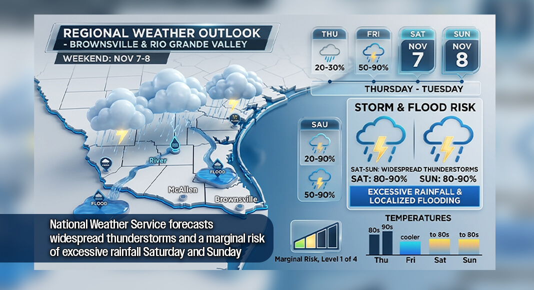
BROWNSVILLE, Texas — The National Weather Service (NWS) is forecasting several days of widespread showers and thunderstorms across Deep South Texas and the Rio Grande Valley, with the potential for heavy rainfall and localized flooding Saturday, November 7, and Sunday, November 8.
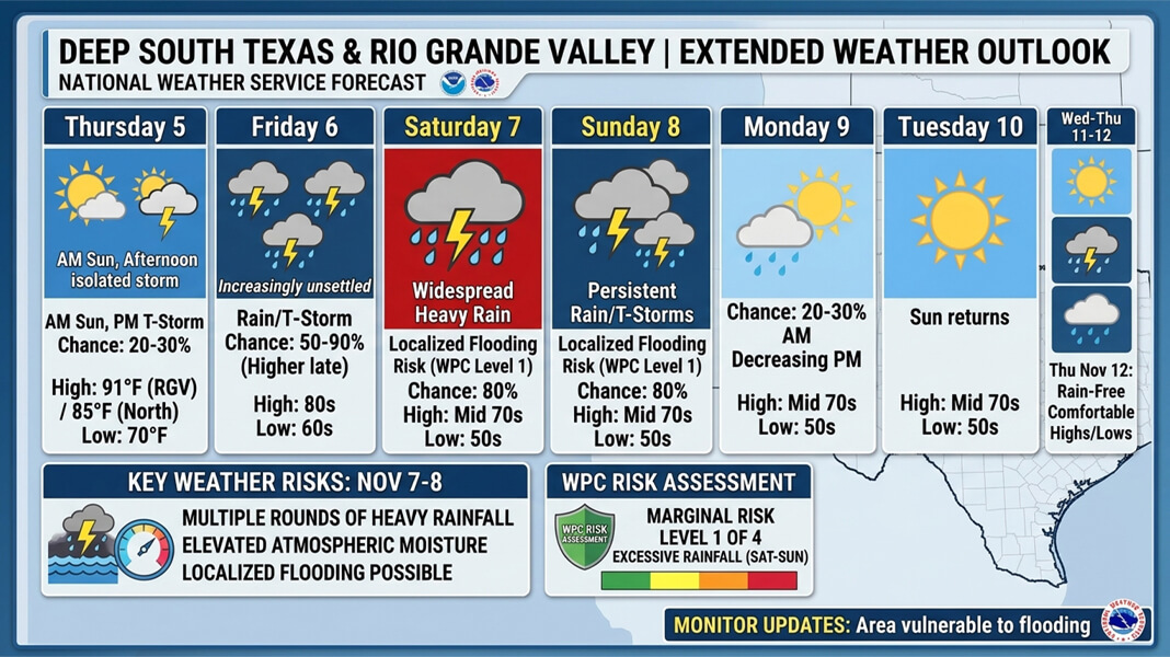
According to the forecast discussion issued at 5:57 a.m. Thursday, November 5, an unsettled weather pattern will develop Thursday night and continue through Sunday night, bringing rain probabilities ranging from 50% to 80% across the region.


The Weather Prediction Center has placed all of Deep South Texas and the Rio Grande Valley under a Marginal Risk, Level 1 of 4, for excessive rainfall Saturday and Sunday.
The designation indicates that heavy rainfall could produce localized flooding, particularly where thunderstorms repeatedly affect the same areas.
Thursday will begin with above-normal temperatures, reaching the mid-80s across the Northern Ranchlands and lower 90s in the Rio Grande Valley. Isolated showers and thunderstorms could develop during the afternoon and evening, with rain chances of 20% to 30%.
Conditions will become increasingly unsettled Thursday night into Friday as an approaching cool front interacts with growing atmospheric moisture and instability.
The NWS forecasts widespread showers and thunderstorms during that period, with precipitation probabilities reaching 50% to 90%.
Additional atmospheric disturbances moving across the region are expected to produce multiple rounds of thunderstorms Saturday through Sunday night.
Forecasters reported elevated atmospheric moisture levels, increasing the potential for heavy rainfall and flooding during the weekend.
Rain chances are expected to decrease to 20% to 30% Monday, November 9, before drier conditions return Monday night into Tuesday.
The NWS expects rain-free weather to continue through Thursday, November 12.
Temperatures will also become cooler, with daytime highs generally ranging from the lower 70s to mid-80s and overnight lows in the 50s and 60s.
Residents should monitor updated National Weather Service forecasts as the weekend approaches, particularly in areas vulnerable to flooding.