














Texas Border Business




Texas Border Business
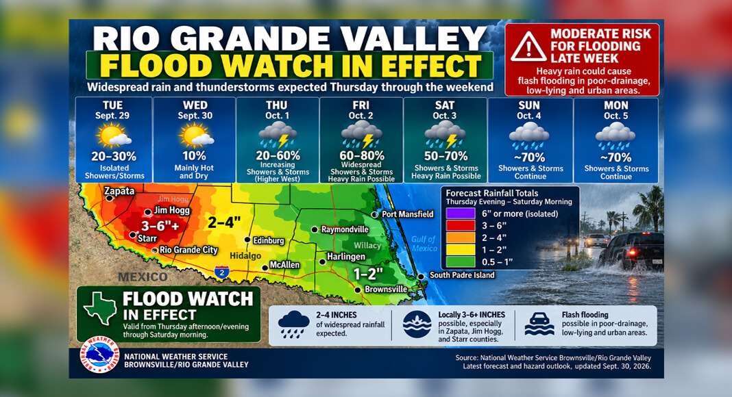
RIO GRANDE VALLEY, Texas — The National Weather Service Brownsville/Rio Grande Valley office has issued a Flood Watch as heavy rainfall and possible flash flooding threaten portions of Deep South Texas from Thursday into the weekend.
The updated forecast Wednesday, Sept. 30, places greater emphasis on rainfall amounts and flooding potential than earlier forecasts, which primarily showed increasing probabilities for showers and thunderstorms.



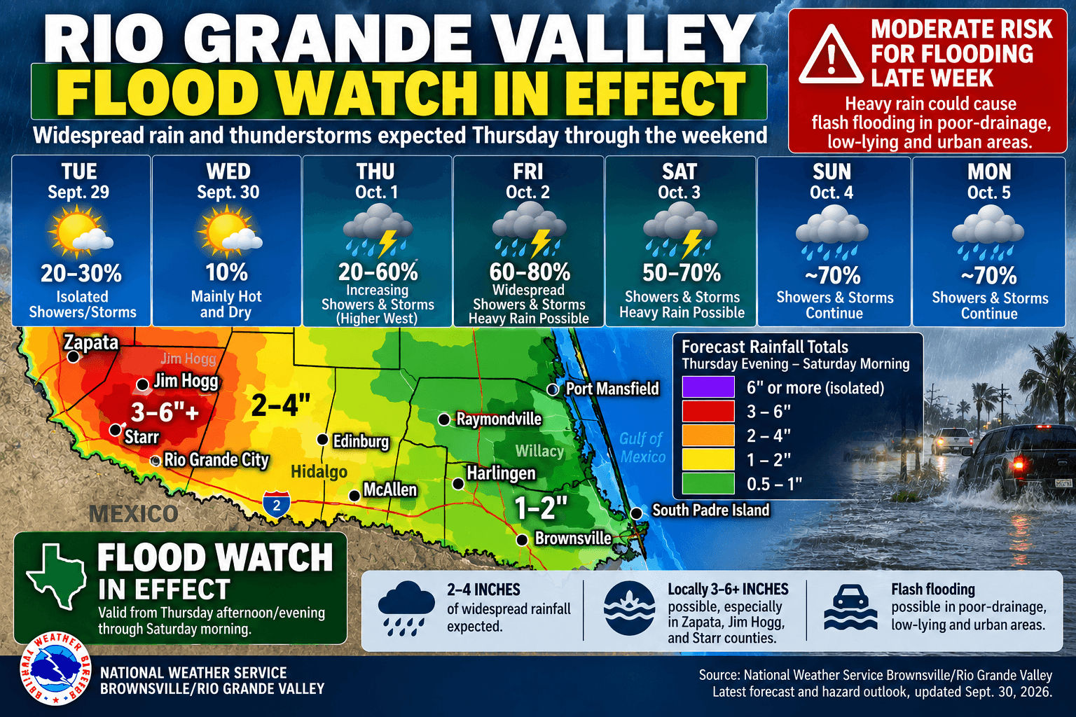
The National Weather Service describes the late-week threat as a “Moderate Risk for Flooding” as a slow-moving cold front interacts with tropical moisture across the region.
According to the NWS, widespread rainfall totals of 2 to 4 inches are expected from Thursday afternoon or evening through Saturday morning. Locally higher amounts of 3 to 6 inches or more are possible.
The greatest rainfall totals are currently expected across Zapata, Jim Hogg and Starr counties. The NWS warns that heavy rainfall could cause flash flooding in poorly drained, low-lying, and urban areas.
The McAllen, Edinburg and Mission metropolitan area is also within the region expected to receive rain and thunderstorms. For McAllen, the NWS forecast shows rain chances increasing to about 60% Thursday and 70% Thursday night.
McAllen, Edinburg, Mission, Pharr, and Weslaco are included within the NWS Southern Hidalgo County forecast area. While the highest projected rainfall totals are currently concentrated farther west, locally heavy rainfall could still affect Hidalgo County depending on where the strongest showers and thunderstorms develop.
Around Harlingen, rain probabilities in the previous forecast reached approximately 60% Thursday night, 80% Friday and 70% through the weekend and into Monday.
The developing weather pattern is expected to begin changing conditions Thursday as the slow-moving front encounters tropical moisture over Deep South Texas. Widespread showers and thunderstorms are expected, with periods of heavier rainfall possible.
The Flood Watch represents an escalation from earlier forecasts that identified isolated flash flooding as possible. The latest outlook provides more specific rainfall estimates and identifies areas where heavier totals could develop.
A Flood Watch indicates that conditions are favorable for flooding but does not mean flooding will occur throughout the Rio Grande Valley. Rainfall totals can vary substantially between communities, particularly when thunderstorms produce concentrated areas of heavier precipitation.
The forecast remains subject to change as the system develops and meteorologists gather additional information about the front’s movement, available tropical moisture, and where the heaviest rainfall will fall.
Residents across the Rio Grande Valley are advised to continue monitoring updated forecasts and any warnings issued by the National Weather Service Brownsville/Rio Grande Valley office as the system approaches.