


Texas Border Business


By Alex Sosnowski, AccuWeather senior meteorologist
A much-needed thaw out from bitter cold and rounds of winter weather has occurred across the battered southern Plains this week thanks to a surge in temperatures and several days of sunny conditions. However, as recovery efforts continue in Texas and other hard-hit states, the spring preview will be halted by a spell of wet and potentially stormy conditions starting late this week.
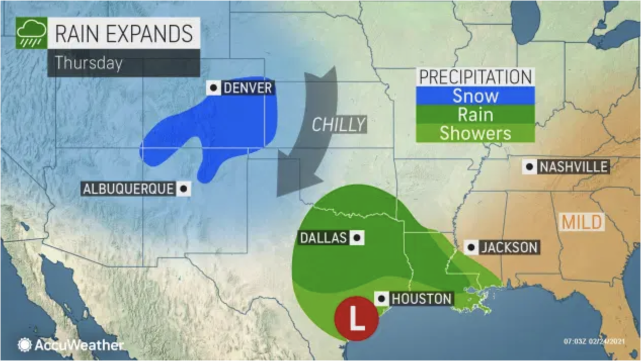
A storm expected to bring moderate to heavy snow in Colorado from Wednesday night to Thursday night is projected to shift eastward and begin to draw moisture northward from the Gulf of Mexico.


As the storm drifts eastward, rain is forecast to develop from the Texas and Louisiana coasts to Oklahoma and Arkansas Thursday.
Following last week’s calamitous winter storms and invasion of Arctic air, a forecast calling for rain may not seem so bad. However, it could be troublesome for those already dealing with home damage from last week’s weather. And, once the atmospheric faucet is turned on, it may be difficult to turn off in some locations.
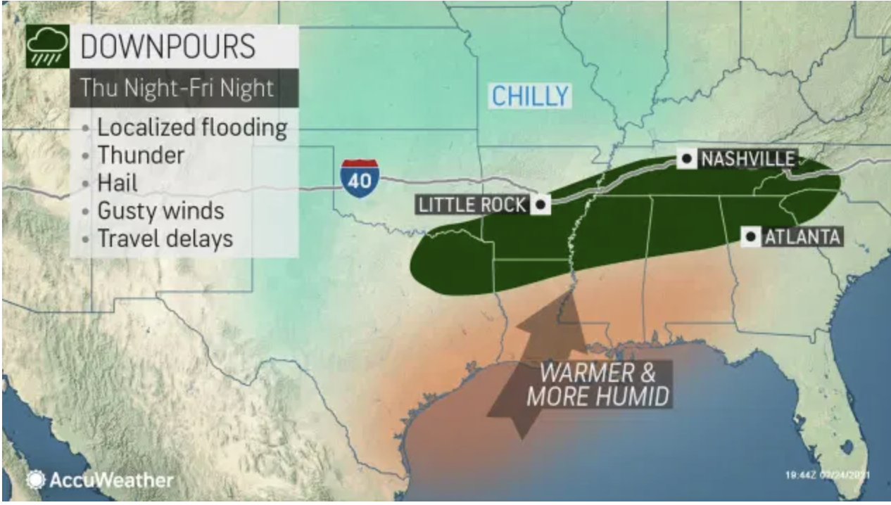
“By Friday, the area of rain is likely to consolidate along a nearly 1,000-mile-long zone from north-central Texas and south-central Oklahoma to upstate South Carolina and western North Carolina,” AccuWeather Meteorologist Matt Benz said.
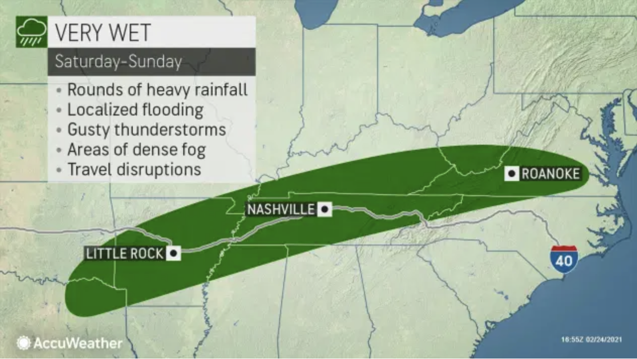
Even though the initial storm will come and go, moisture is likely to remain behind in roughly the same zone this weekend, and perhaps into the first part of next week.
“As the additional disturbance moves eastward through this zone into next week, more rounds of drenching rain are likely and that could lead to some flooding problems,” AccuWeather Senior Meteorologist Brett Anderson said.
Cumulative rainfall over a five- to seven-day period is forecast to range from 2-4 inches, with forecasters cautioning that there is the potential for double that amount locally.
The rain will fall on some locations where 1-2 feet of snow fell during the siege of winter storms from last week. Fortunately, all of this snow will have melted prior to the arrival of the rain and should allow most rivers in the region to handle the new runoff. However, the combination of wet soils and repeating rainfall may lead to localized small stream flooding. Urban flooding during episodes of heavy rain is almost a certainty in the pattern, especially where some lingering piles of snow block storm drains.
Part of the area forecast to received drenching rain is experiencing abnormally dry to moderate long-term drought conditions, according to the United States Drought Monitor. This includes parts of Arkansas, Tennessee, Mississippi and Alabama.
In addition to the likelihood of multiple days of wet weather, there is also the potential for severe thunderstorms.
“We expect at least a couple of rounds of heavy, gusty thunderstorms in the pattern mainly near and south of the west-to-east band of persistent rains,” AccuWeather Senior Storm Warning Meteorologist Eddie Walker said.
“But with locally strong disturbances in the jet stream likely to accompany the pull of warm and humid air from the Gulf of Mexico, there is also the possibility of severe thunderstorms,” Walker said.
The coverage and intensity of the thunderstorms has yet to be determined and may hinge on the timing and strength of the disturbances versus where the disturbances coincide with daytime heating, forecasters say.
Sunshine can boost temperatures and make the atmosphere more unstable, which may then increase the intensity and coverage of thunderstorms. However, the presence of a deck of low clouds that limits daytime warming may deter severe weather. Both conditions are possible in different areas on different days south of the zone of persistent rain.
A nocturnal severe weather event may unfold as well.
“One zone that may have heavy thunderstorms with large hail is from northeastern Texas to southern Arkansas from Thursday night to Friday morning,” Walker said.