


Texas Border Business
- Advertisement -
Weather Forecast for the Rio Grande Valley (July 5 – July 9, 2024)
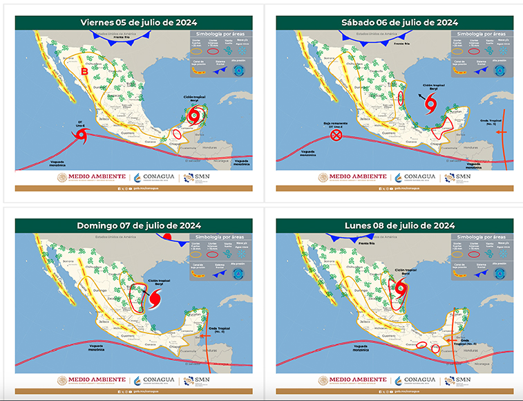
| Friday, July 5 |
| High: 96°F |
| Low: 79°F |
| Conditions: Sunny, heat index values up to 105°F. Southeast winds 8-13 mph with gusts up to 21 mph. |
| Saturday, July 6 |
| High: 95°F |
| Low: 78°F |
| Conditions: Mostly sunny during the day. A 20% chance of showers and thunderstorms at night. East winds 6-13 mph with gusts up to 20 mph. |
| Sunday, July 7 |
| High: 89°F |
| Low: 78°F |
| Conditions: Showers and thunderstorms likely, especially in the afternoon and evening, with heavy rainfall possible. Northeast winds 9-17 mph with gusts up to 22 mph. Chance of precipitation is 70%. |
| Monday, July 8 |
| High: 90°F |
| Low: 80°F |
| Conditions: Cloudy with a 50% chance of showers and thunderstorms throughout the day and night. Southeast winds 10-18 mph with gusts up to 23 mph. |
| Tuesday, July 9 |
| High: 93°F |
| Low: 80°F |
| Conditions: Mostly cloudy with a 50% chance of showers and thunderstorms. Southeast winds 9-14 mph. (National Weather Service). |
Hurricane Beryl’s Impact on South Texas
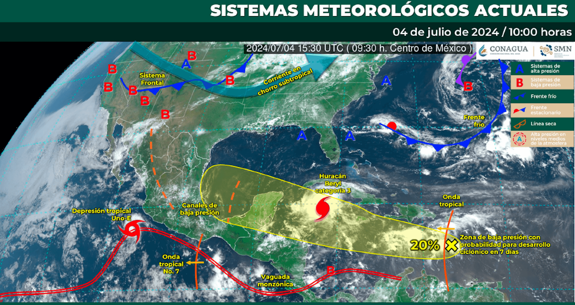
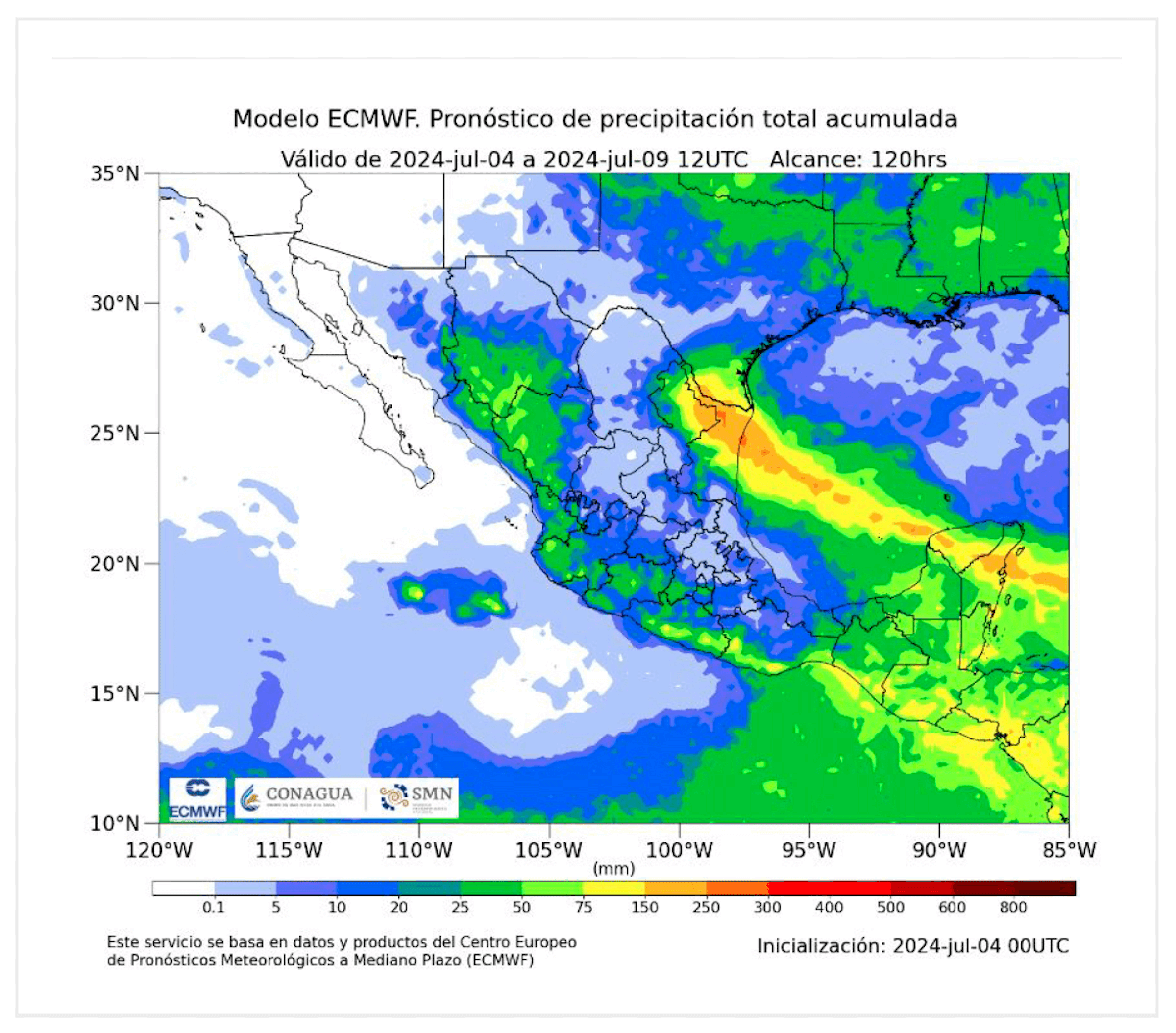
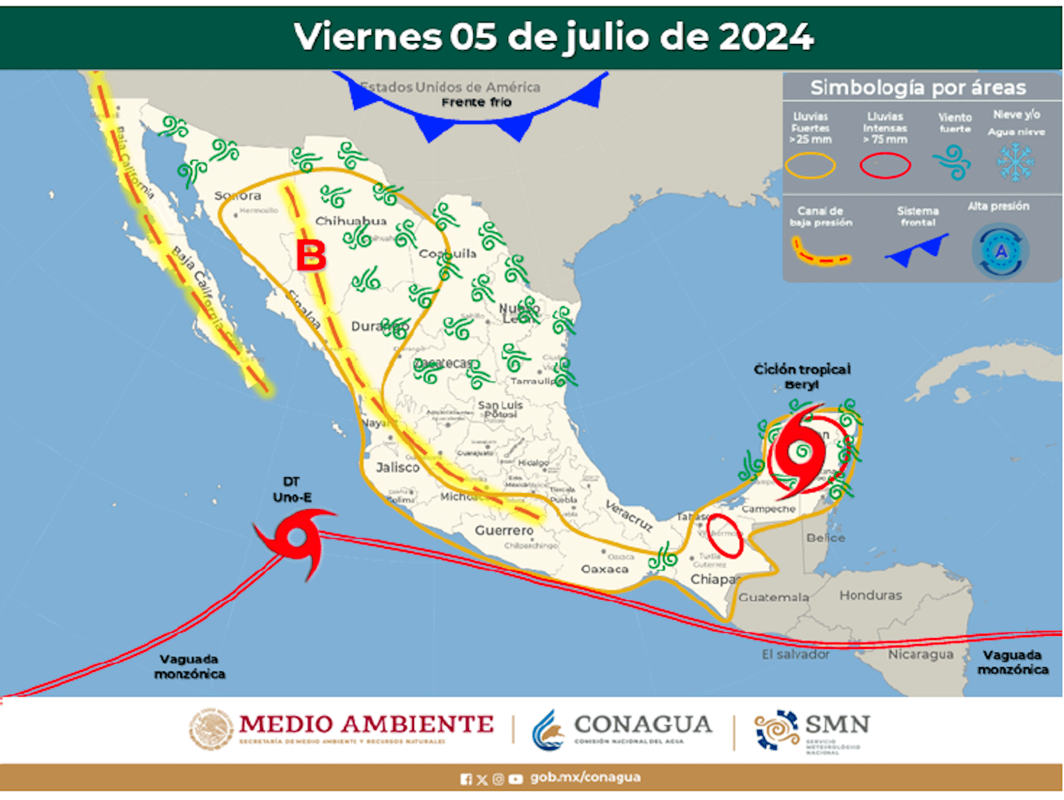
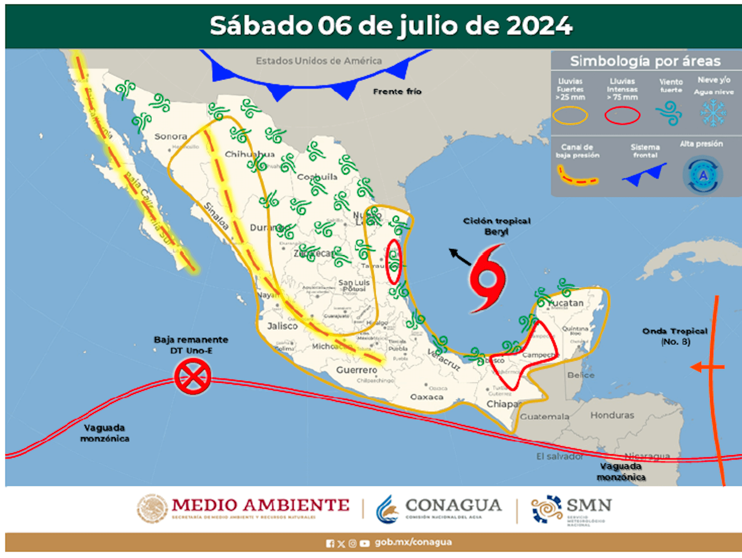
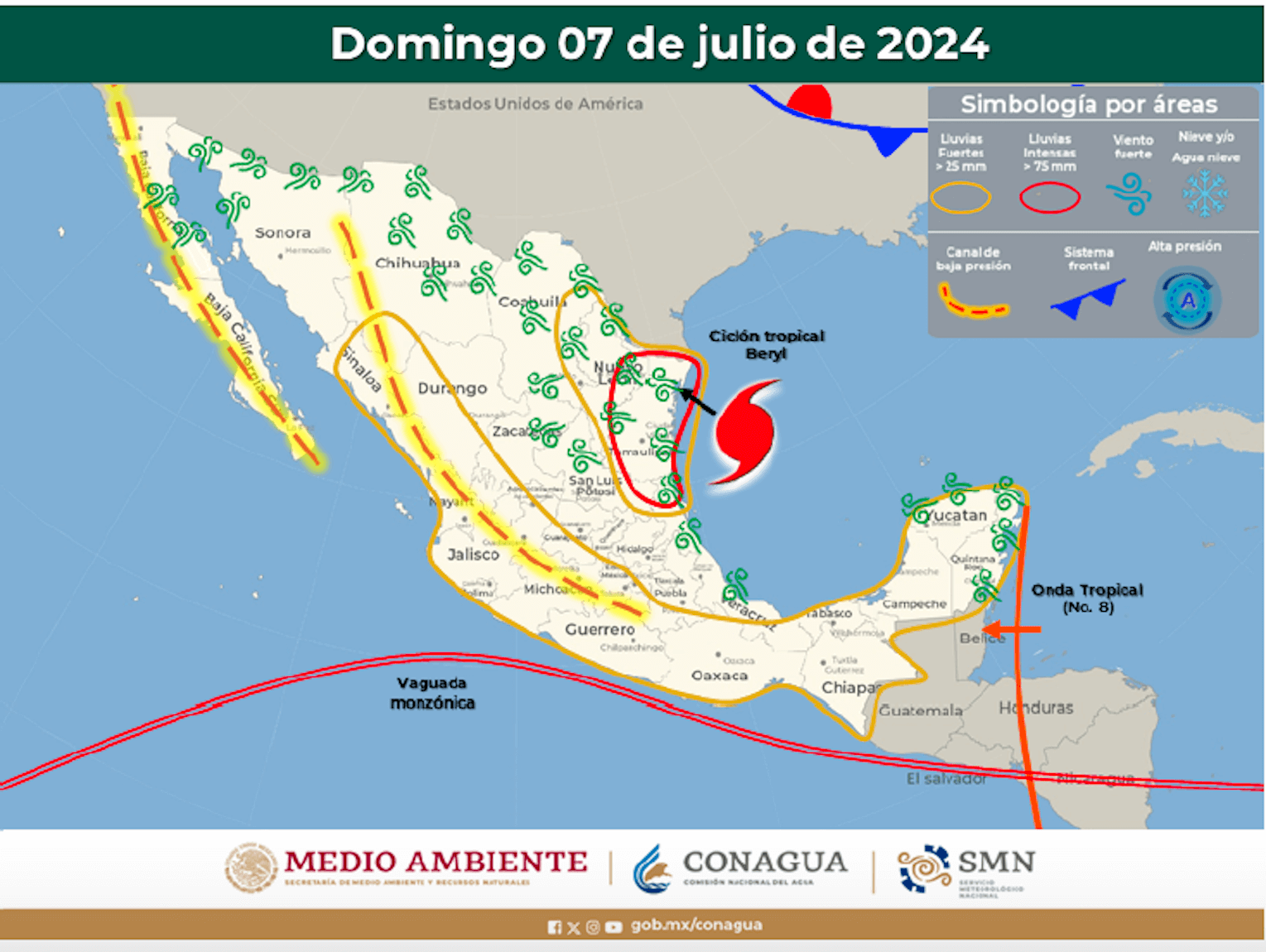
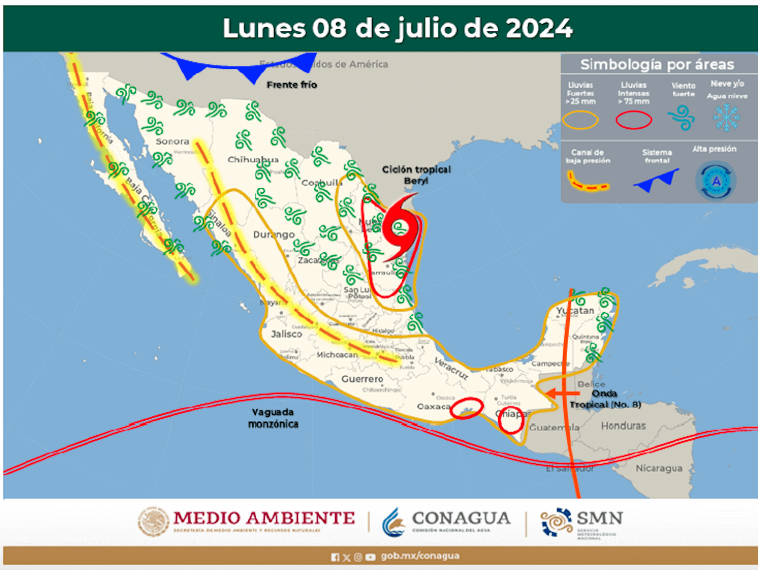
Hurricane Beryl is expected to bring significant weather changes to South Texas, particularly the Rio Grande Valley, starting Sunday, July 7. Here are the key impacts:
- Advertisement -
- Heavy Rainfall: Beryl will bring periods of heavy rain starting Sunday, with the highest chances of precipitation on Sunday and Monday. This could lead to localized flooding in low-lying areas.
- Wind: Expect strong winds, especially on Monday, with gusts up to 25 mph. These winds may cause minor property damage and make travel hazardous.
- Coastal Impacts: Dangerous rip currents and high surf conditions will affect the beaches of the lower Texas coast. Tidal run-up could also lead to minor coastal flooding.
- Thunderstorms: There is a high probability of thunderstorms, some of which may produce heavy rainfall, contributing to potential flash flooding (Weather.gov).
Residents are advised to stay updated with Tim Smith KRGV-TV5 weather reports and follow any advisories or warnings issued by the National Weather Service to ensure safety during this period.
- Advertisement -