


Texas Border Business

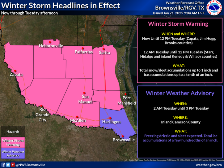
A Winter Storm Warning is now in effect for Zapata, Jim Hogg, Brooks counties until noon Tuesday. A Winter Storm Warning went into effect 12 AM for Starr, inland Kenedy, inland Willacy, and Hidalgo counties noon Tuesday. Total snow and sleet accumulations of up to 1 inch and ice accumulations up to a tenth of an inch is possible. A Winter Weather Advisory is in effect for inland Cameron county from 2 AM Tuesday to 3 PM Tuesday. Freezing rain and sleet is expected. Total ice accumulations of up to a few hundredths of an inch are possible.
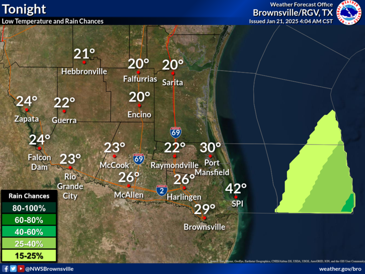
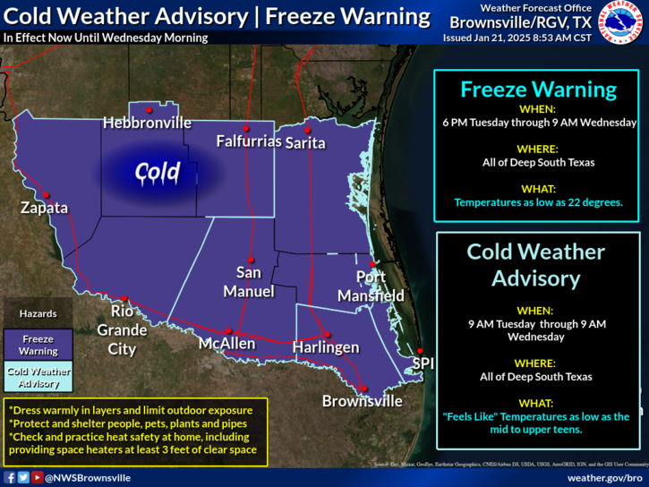
There is a freeze warning for all of deep South Texas (except the barrier islands) from Tuesday evening through mid-Wednesday morning. Temperatures may get as low as 22 degrees. There is also a cold weather advisory in effect for the same area from 9 AM today through 9 AM Wednesday morning. “Feels Like” temperatures may get as low as the teens. Remember, pets, plants, pipes, and people should be protected from the cold.
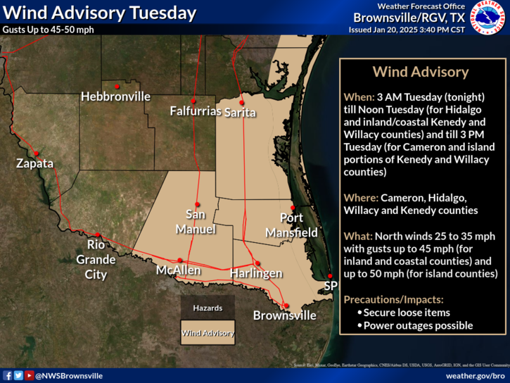
A Wind Advisory went effect at 3 AM Tuesday till noon Tuesday (for Hidalgo and inland/coastal Kenedy and Willacy counties) and till 3 PM Tuesday (for Cameron and island portions of Kenedy and Willacy counties).

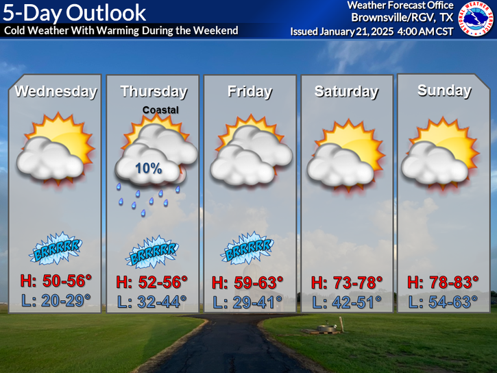
Near record low temperatures will be possible Tuesday night into Wednesday morning followed by a gradual warming trend during the weekend as the winds return to the southeast.