


Texas Border Business

By Roberto Hugo González
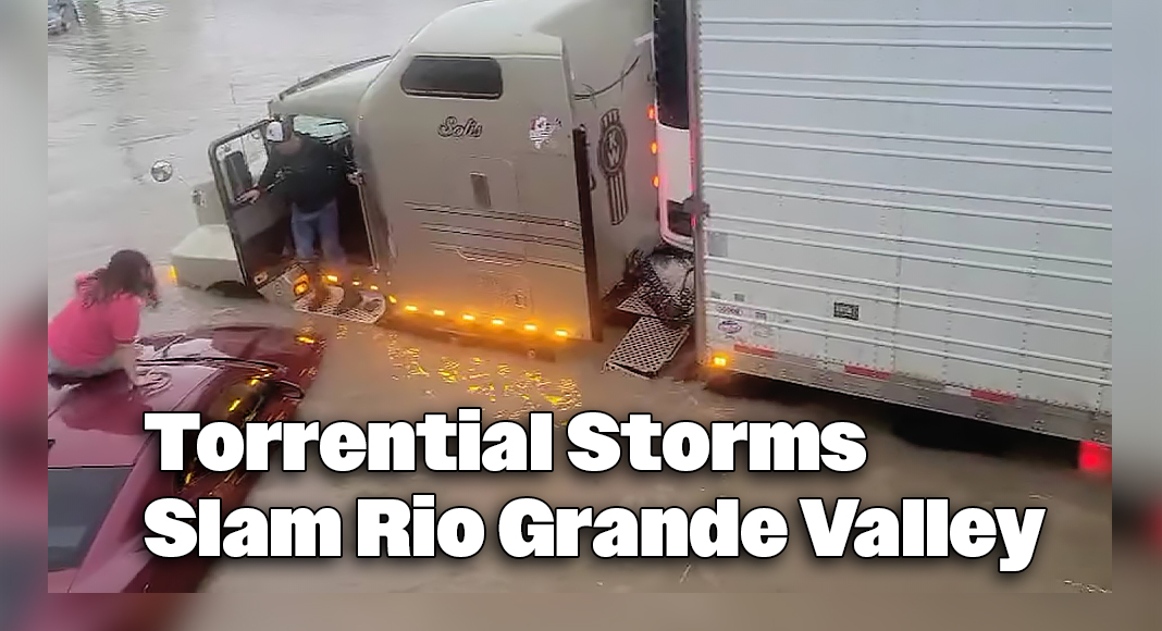
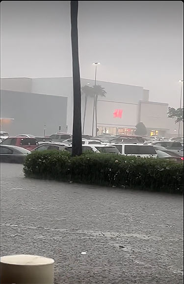
RIO GRANDE VALLEY, Texas — A severe weather system brought the Rio Grande Valley to a standstill on Thursday, March 27, as torrential rains, dangerous thunderstorms, and a rare tornado warning battered the region. As of early Friday morning, March 28, the immediate tornado threat had passed. However, the aftermath continues to impact communities across Hidalgo and Cameron counties, with widespread flooding, school and business closures, and emergency shelter openings.

Tornado Warning Rocks Hidalgo Count
At 3:45 p.m. Thursday, the National Weather Service (NWS) in Brownsville issued a tornado warning for east-central Hidalgo County, including Elsa, Edcouch, and San Carlos. The warning remained in effect until 4:15 p.m. and was accompanied by a risk of quarter-sized hail. The radar indicated strong rotation within the storm, prompting an urgent alert.
While no tornado touchdown has been officially confirmed, the event accentuates the rarity—and danger—of such weather in the Valley.
As of 6:11 a.m., the tornado warnings had expired, but officials urge residents to stay alert as weather conditions may shift rapidly.
Flash Flooding Submerges Cameron County
In Cameron County, overnight storms dumped several inches of rain, leading to widespread street flooding, particularly in South Padre Island. Businesses like The Grapevine Cafe and Coffeehouse and the South Padre Island Golf Club & Resort were temporarily closed after their parking lots and nearby roadways were overwhelmed with water.
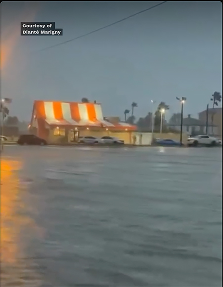
Residents reported water levels several inches deep along Padre Boulevard and surrounding areas, severely restricting travel and prompting calls for caution.
Severe Storms Pound Region with Wind and Hail
Strong thunderstorms rumbled across Zapata, Starr, and Hidalgo counties on Thursday. The NWS recorded isolated wind gusts up to 70 mph and hail as large as one inch in diameter. These storms contributed to power outages, fallen trees, and damaged regional infrastructure.
The information regarding strong thunderstorms affecting Zapata, Starr, and Hidalgo counties, with wind gusts up to 70 mph and hail up to an inch in diameter, originates from forecasts and reports by the National Weather Service (NWS) in Brownsville. Meteorologist Brian Miller from NWS-Brownsville indicated that isolated severe thunderstorms were expected to impact these areas, bringing the potential for such severe weather conditions.
Flood Watches and More Rain to Come
“McAllen got 8 to 12 inches of rain,”
Mayor Javier Villalobos
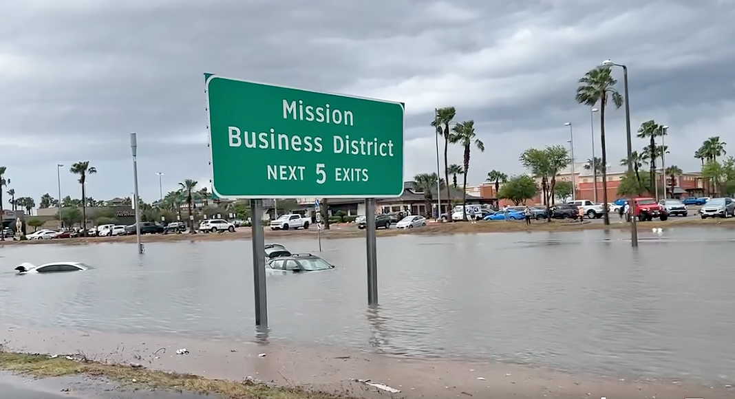
With additional rain forecast through Friday, the NWS has issued ongoing flood watches throughout the Valley. Total rainfall estimates from the storm ranged between 6 to 10 inches in some areas by Friday morning, with localized totals in McAllen approaching 12 inches.
As of March 27, 2025, the National Weather Service (NWS) issued flood watches for the Rio Grande Valley due to forecasts of additional rainfall through Friday. Some areas were expected to receive between 6 to 10 inches of rain, with localized totals in McAllen approaching 12 inches.
However, the provided sources do not provide specific rainfall measurements for McAllen on March 27, 2025. The RainDrop App reports no recorded rainfall for that date. Additionally, Weather Underground’s historical data for McAllen on March 27, 2025, indicates no data recorded.
Therefore, while flood watches were in effect due to anticipated heavy rainfall, precise accumulation figures for McAllen on March 27, 2025, remain unconfirmed based on the available information.
Emergency Responses and Water Rescues
First responders worked around the clock Thursday and Friday, conducting numerous water rescues for stranded drivers and residents caught in rising floodwaters. Emergency management teams urged residents not to drive through flooded roads—a warning reinforced by the regional campaign slogan, “Turn Around, Don’t Drown.”
Shelters Open in Pharr
The City of Pharr responded swiftly to the crisis, opening two emergency shelters for displaced or stranded residents:
• Jose “Pepe” Salinas Recreation Center, 1011 W Kelly Ave
• Pharr Development and Research Center, 850 W Dicker Rd
Residents are advised to bring identification, medications, and blankets. Pets are not allowed at these facilities.
The city also announced numerous street closures due to flooding, including major roadways like W. Polk Ave, W. Hall Acres, and W. Moore Road.
Closures Disrupt Daily Life
With roads submerged and forecasts calling for more rain, several institutions closed operations for Friday, March 28:
• Mission CISD: All schools and offices closed
• McAllen ISD: Classes canceled district-wide
• South Texas College (STC): All campuses closed Friday; operations to resume Monday, March 31
In a joint message to families, school districts cited safety concerns and coordination with emergency management in making the decision.
McAllen Grapples with Flooding, Outages

The City of McAllen faced some of the heaviest rainfall, with water levels reaching between 8 and 12 inches in parts of the city, according to McAllen Mayor Javier Villalobos early this morning. Floodwaters inundated roads, knocked out power, and overwhelmed traffic signals across the area. Numerous intersections and streets were closed, including:
• 2nd St. from Yuma Ave. to Ridge Rd.
• 23rd St. from Pecan Blvd. to La Vista Ave.
• Ware Road between Orchid Ave. and Nolana Ave.
• McColl Ave. from Business 83 to Ridge Rd.
Additionally, power outages disrupted signal lights along major intersections, such as Main St. and Trenton Rd., 10th St. and Fern Ave., and Bicentennial Blvd. and Jackson Ave.
Crews from McAllen Public Works and Traffic Services continue working around the clock to restore service, transparent drainage systems, and reopen roadways.
Though floodwaters are beginning to recede in some areas, authorities emphasize that recovery will take time. Additional rainfall overnight may further delay progress. Residents are urged to stay off the roads unless necessary, follow local updates, and report any flooding issues through McAllen 311.
This historic weather event has tested the region’s resilience. Still, with coordinated emergency responses, ongoing public alerts, and community solidarity, the Rio Grande Valley is pushing forward—one day at a time.
In Case of Emergency:
• Dial 9-1-1
• For local flood reports: McAllen 311
• Follow updates from NWS Brownsville, city emergency management pages, and local news stations. Stay safe and stay informed.