


GIS will enhance user experience for residents and developers
Texas Border Business
Mission, TX – The City of Mission is going through a massive transformation. As the population grows, small businesses and developers are clamoring to take advantage of the demand and the rapid growth in the area. As a result, the city’s planning and zoning department have launched a new mapping system.
A Geographic Information System (GIS) is a platform that captures, stores, checks, integrates, analyzes and displays data related to a position on the Earth’s surface.
“With this unique capability, GIS reveals deeper insights into data, such as patterns, relationships, and situations—helping users and decision-makers make smarter decisions,” Deputy City Manager David Flores said. “In other words, a GIS takes real
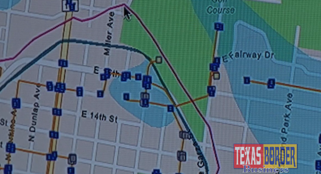
The new mapping system allows for a more enhanced user experience and will assist business owners and developers looking at investing in the city with detailed demographics, local transit and other vital resources that will assist in finding the perfect location.
“We have seen more commercial projects in the past 12 months than we have in previous years. We have more exciting changes in the works for Mission in the months to come and this is just the beginning,” Planning Director Jaime Acevedo said. “GIS will provide planners, developers,
Location is everything when it comes to opening a new business location or developing a new housing or commercial project in Mission. This tool will better assist the decision


“City information exists in various formats like paper maps, digital databases, and recorded documents. A GIS compiles this information into a single system allowing our staff to process and analyze information within minutes rather than days or weeks,” Flores said. “The improved efficiency saves hundreds of hours, saving taxpayer dollars.”
The GIS will also improve public and emergency services to residents.
“It puts the power of information in their hands. Residents no longer have to go to city hall to request information on the location of a water line or where a city building is,” B2Z Engineering Project Manager Armando Pompa said. “With online GIS web maps, they will be able to view all that information on their computer or smart devices.”
Developers will now have a source to view the City of Mission’s infrastructure online to determine the feasibility of their projects.
“The ability to see where water, sanitary sewer,
The new GIS is available through the city’s website www.missiontexas.us. It is also mobile


